


"Out of Habersham"
by Randy Golden
exclusively for About North Georgia
Scramble 200 feet down Coon Den Ridge from the Appalachian Trail (AT) and a leaf covered spring is usually visible even to the casual visitor. From this gentle outflow a mighty river is created. It flows through the heartland of Georgia, both physically and historically. Clean, fresh, and sparkling at this point, the water is begining a 500+ mile journey to the Gulf of Mexico as the Chattahoochee River.
Headwaters to Helen
In Chattahoochee Gap near the intersection of Jack's Knob Trail and the Appalachian Trail, a blue sign with a white "W" points towards the headwaters of the Chattahoochee River. A short descent from the AT takes hikers to a spring where fresh water flows year-round; this is the start of the Chattahoochee River. Leaving the spring the river is barely a small stream. As it wanders down Hiawassee Ridge the river grows, picking up water from many unnamed rivulets. At 1.3 miles (Horse Trough Mountain) the first bridge spans the riverbed, now almost four feet wide. The bridge carries hikers to beautiful Horse Trough Falls.

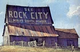
The Shoot
Courtesy Joe and Monica Cook
Now plunging more than 1500 feet in less than ten miles the river grows rapidly as many tributaries join it in the Mark Trail Wilderness Area, which was created specifically to protect the Chattahoochee River's headwaters and watershed by the United States Forest Service. More than 16,000 acres of camping, hiking, fishing and scenic driving in this wilderness can be accessed by the Chattahoochee River Road (FS 44). Winding for 11 miles the road parallels the Chattahoochee River along the river's steepest descent. From its start .5 miles south of Unicoi Gap this winding, occasionally steep road is an excellent fall drive, with many deep reds early in the leaf change season (peak time is normally Oct. 15-20).
As use of the Chattahoochee National Forest has grown, so has the impact on the river. Camping, especially primitive camping, where ignorant or uncaring campers leave garbage and human waste near the Chattahoochee has an obvious negative impact on the river. Frequent use leaves the campsite areas barren and rains wash the exposed Georgia clay into the river more quickly. By the time the Chattahoochee River leaves Mark Trail Wilderness Area it is a good trout stream, sometimes navigable after a heavy rain. In spite of the nearby camping, the river remains relatively undisturbed. It was not always that way.
From the early 1800's until the 1930's the Unicoi Turnpike climbed to Unicoi Gap along the ecologically fragile banks of the Chattahoochee River north of Helen. The roadway connected settlers in Tennessee to the Savannah River and was one of the routes used to bring supplies inland. Starting in 1829 use of the Unicoi Turnpike increased dramatically. It became a major shipping route for the gold that had been discovered in the Chattahoochee's watershed during the Georgia Gold Rush.
Gold played an important role in the early history of the upper Chattahoochee. The mineral had been taken from various places along the river since the 1500's, but it was Georgia's Gold Rush that would send this portion of the Chattahoochee watershed into a century-long ecological tailspin. At first prospectors would pan for gold. This activty reduced or destroyed the riparian buffers (the fauna that transitions from river to forest) in the areas of greatest activity. Once the alluvial gold had been taken, mines were dug, increasing the pollution with run-off. In the 1850's hydraulic mining took an even greater toll on the land and the river, leaving barren earth where forests once stood.
Between 1850 and 1880 farmers built homesteads on the banks of the river. For thirty years the area supported these farmers, but crop failure became an increasing problem because of poor farming techniques. The farmers slowly sold out to lumber companies eager to harvest the upcountry trees that the farmers had not cleared. From 1880 until 1930 lumber companies like Byrd-Matthews in Helen, Georgia, routinely clear-cut wide areas of land. By 1895 the entire watershed of the Chattahoochee north of Helen was an environmental disaster. Soil erosion from these barren mountains clogged the river for the rest of its 350 mile journey through the heart of Georgia.
Starting in 1910 the federal government began to buy the devastated land at rock bottom prices. It was considered worthless. Over the last century the land was allowed to return to its original state. In the 1930's Franklin Delano Roosevelt's Civilian Conservation Corps planted trees throughout the watershed. Today, thanks to the Forest Service management only camping is permitted along the river.

Chattahoochee River
"The Hooch" is a nickname bestowed upon the river by sportsmen and outdoor recreation fans alike.
Smith Creek (Smith Creek Trail), formed at Anna Ruby Falls, is the first major river to join the Chattahoochee. This creek doubles the size of the river's watershed just before it enters Georgia's Alpine village of Helen (Helen's history and tourist information). During the early 20th century both Smith Creek and this portion of the Chattahoochee River served as a transportation route for the lumber cut in the upper watershed. Wood was floated downriver to the Byrd-Mathews saw mill in Helen. Here it was cut and shipped south by rail to Atlanta. In the 1920's the industry had cleared most of the land and moved further west.
On the rocky riverbanks hotels, restaurants, shops and manufacturing all impact the river. Additionally, the large festivals the city holds, such as Oktoberfest, attract hundreds of thousands of people to the banks of this still young river. Luckily, the townspeople have taken an active stewardship towards the Chattahoochee. While the rapid growth of the city has destoyed much of the riparian zones Helen is actively working on reducing its impact on the waterway. For example, wastewater is treated, then filtered through land before returning to the river.
Helen to Belton Bridge
South of Helen the river begins a wide, sweeping curve, forming the northern end of Nachoochee Valley. Wider and stronger the Chattahoochee is navigable from this point to the Gulf of Mexico. At the intersection of Highway 75 and 17 a gazebo rests high atop the northernmost remnant (on this river) of prehistoric moundbuilder culture known as the Mississippeans. By 1500 AD the Moundbuilder culture had left the area and they were gradually replaced by the Cherokee. This portion of the river was known as the Chota to the Cherokee.
More major rivers (Dukes Creek, Soque River) join the Chattahoochee, increasing its watershed. Canoeing is popular, with a number of well-known places to put-in. Through the lovely, wide Sautee-Nachoochee Valley the river winds east, then south as it enters increasingly populated areas.
In treaties signed with the United States in 1817 and 1819 the Chattahoochee River was used to delineate the eastern border of the Cherokee Nation. Further south it formed the border between the Creek Nation and the Cherokees. In the late 1830's both these Nations would be forcibly moved west, the Cherokee in a sad series of events today called The Trail of Tears, the Muscogee tribes in a flight generally referred to as the Creek Removal.
As the Chattahoochee forms the boundary between Habersham and White County the health of the river is challenged by the increase in population as well as run-off from high production chicken and cattle raising techniques in use near its banks. Erosion, too, creates a problem. River banks play an important part in the health of the Chattahoochee. As urban sprawl claims more land, the plants, trees and grass near the banks are destroyed and soil dumps into the river. In spite of the challenges in this area the ecological effort is still preservation; further south it becomes a rescue mission.
Georgia's poet-laureate Sidney Lanier wrote a poem called "Song of the Chattahoochee," about the river that runs through Georgia's heartland:
Out of the hills of Habersham,
Down the valleys of Hall,
I hurry amain to reach the plain,
Run the rapid and leap the fall,
Split at the rock and together again,
Accept my bed, or narrow or wide,
And flee from folly on every side
With a lover's pain to attain the plain
Far from the hills of Habersham,
Far from the valleys of Hall.
So out of the "hills of Habersham" we follow our river to the "valleys of Hall." Only the valleys that Lanier speaks of so eloquently no longer exist. They are covered by the waters of the Chattahoochee, dammed some 26 miles further south, backing up at normal level to Belton Bridge. The soil and pollution that has washed into the river further north is about to come to a stop in Lake Sidney Lanier
Chattahoochee River.
North of Atlanta
by Randy Golden
exclusively for About North Georgia

Fishing on a foggy morning at Bowman's Island
Leaving Buford Dam, the Chattahoochee River flows into the pristine Bowman's Island Unit of the Chattahoochee River National Recreation Area, the southernmost cold water trout stream in the world and the first of the series of federal parks that define the river over the next 20 miles. The rugged environment, barely two miles long, is beloved by fishermen throughout the Southeast. Two hiking trails explore the northern portion of the Chattahoochee River here, the Buford Dam Trail and the Laurel Ridge Trail. Over the next 13 miles only two crossings of the Chattahoochee exist today, GA Highway 20 and McGinnis Ferry Road.
Highway 20 crosses the river at Fish Weir Shoals, where Cherokee Indians built a wattle dam to help them catch fish. The Cherokee were plentiful in today's Forsyth County. The Chattahoochee served as a dividing line of sorts between the Cherokee and Creek Nations, especially in this section of the river. Following battles in Slaughter Gap (west of Blood Mountain) and Taliwa, near present-day Ballground, the Indian Nations established a border defined as the first ridge south of the Chattahoochee. Here the border was closely enforced -- either Nation crossing it could start a war. Further on, where the Cherokee did not have many towns, a trading zone grew where both Cherokee and Creek could transact business.
In addition to McGinnis Ferry, there were other crossings, most notably Orr's Ferry, Settles Bridge and Rogers Bridge. The Rogers brothers, George and William, were a notable historic family. These two mixed-blood Cherokee were wealthy and they signed the Treaty of New Echota. Once in Oklahoma, George decided to return to Georgia and sued the state of Georgia for the right to purchase his home from the settlers who won it in the 1832 Georgia lottery. In 1839 his suit resulted in the overturning of Georgia's removal law, but by that time it was too late for the Cherokee Indians - they had already been forced west on the Trail of Tears. George's brother William is also famous - his grandson was a homespun comedian before World War II, Will Rogers.
Today's Suwanee, Georgia is the first major city near the river south of Buford Dam. Until 1820 Suwanee, Cherokee for "echo," was a Cherokee village near the confluence of Suwanee Creek and the Chattahoochee River. As settlers in North and South Carolina encroached on Indian land, the Cherokee from those areas moved to west Georgia, past Suwanee. At this point the town became known as Suwanee Old Town.
Suwanee Creek was once a major point source of pollution of the Chattahoochee River. Flowing south from Buford, the river was the dumping grounds of the Bona Allen Tannery (now Tannery Row). For many decades, Bona Allen Tannery was the largest in the world and chemicals and dyes from the plant were dumped into Suwanee Creek. From here they made the journey to the Chattahoochee. When the plant closed in the 1970's, environmentalists thought it would take a hundred years for the land to become fertile, but only 30 years later the creek is the centerpiece of the Suwanee Greenway.
From Abbotts Bridge Road north, only 3 small parcels of land are unprotected by the state and federal government. Both park, state and city officials consider this land "undeveloped" and intend to use them for various purposes as Atlanta expands north. South of Abbotts Bridge housing is frequently visible from the riverbank, in some cases illegally encroaching on the 50-foot easement from the 100-year flood plain. The Chattahoochee River National Recreation Areas south of this point have at least some development and many are completely developed. Abbotts Bridge and Medlock Bridge have boat ramps, and Jones Bridge has a nice take-outs near either parking lot.

Jones Bridge
At Jones Bridge (on Barnwell Road north of Holcomb Bridge Rd.) are the remains of an antiquated vehicular bridge, abandoned in 1922, but used until the wooden floor boards rotted. In 1940 workmen dismantled half the bridge, probably to sell the scrap metal in the open market. They never returned for the second half, which remains as a historic reminder of a by-gone era. Jones Bridge features some 5.0 miles of hiking trails, including a loop near the Chattahoochee River Environmental Education Center, a facility used to instruct classes on the importance of the river.
Located in Island Ford (GA 400, exit 6, turn left at the stop sign, then right on Dunwoody Place and Roberts Drive) are the headquarters of the Chattahoochee River National Recreation Area, in the rustic home of Judge Samuel Hewlett, who served on Georgia's Supreme Court. The land was purchased by the federal government from his estate. Island Ford, which later became a ferry, never progressed to a bridge because of lack of traffic and competition from nearby Jones Bridge and Roswell Bridge. Today it is hard to imagine fording the river at this point because of Buford Dam, 28 miles upstream. The water level is kept high by the continuous flow requirement for the dam set by the Corps of Engineers. Before the dam the water level would drop a few days after the rain and expose Island Ford Shoals.
Bull Sluice Lake from the

Chattahoochee Nature Center
Past Island Ford on the opposite bank of the river, the city of Roswell, Georgia has developed a series of small parks connected by a multi-use trail that gives bike riders and walking enthusiasts a 3-mile long Riverwalk to practice their sports. The path presently begins at Don White Park and runs to the intersection of Azealia Drive and Willeo Road, according to Jeff Pruitt, Administrator of Park Services for Roswell. Pruitt told us of plans to connect Don White with the Big Creek Greenway in Alpharetta. The path passes through the Vickery Creek Unit of the Chattahoochee River NRA, which affords more than 5 miles of hiking opportunity, and in September, 2004, Roswell built Georgia's newest covered bridge connecting the unit to Roswell Mill Trail. Also along the bike trail is the Chattahoochee Nature Center, which features an interpretive center including raptors as well a three miles of hiking trails.
During the Atlanta Campaign, Cavalry General Kenner Garrard captured Roswell Mill (hike to Roswell Mill) just north of the Chattahoochee on Vickery Creek/Big Creek on July 5, 1864. General George Thomas's troops crossed the river for the first time in this area on July 16. From here they moved south and engaged the Army of Tennessee in the Battle of Peachtree Creek on July 22.
The last of the Chattahoochee River National Parks above Morgan Fall Dam is Gold Branch, whose 5 miles of hiking trails attracts experienced hikers (there are some hiking areas that are dangerous) and includes a significant portion of the original Roswell Road. We could not find any information on successful gold mining in the area, so the creek may have been named by a hopeful settler. At Gold Branch the park is no longer bound by river bank, but by lake shore. Bull Sluice Lake is the impoundment of Morgan Falls dam. Completed in 1904, the dam was purchased by Georgia Power in 1912 and is still used to generate electricity for Atlanta.
End of the Journey
by Randy Golden
exclusively for About North Georgia

Morgan Falls Dam
Our journey down the Chattahoochee River has brought us from the upper reaches of White County to the shores of Lake Lanier, the most popular Corps of Engineers lake in the Southeast United States. From Bowman's Island we journeyed through the Chattahoochee River Valley to Bull Sluice Lake, created by the Morgan Falls Dam. In the final chapter of our Chattahoochee journey, we follow the river to its near death, courtesy of the pollution created by the city of Atlanta and its northern arc of suburbs.
As the water of the Chattahoochee River leaves Morgan Falls Dam it passes the popular Morgan Falls boat ramp and continues a 436 mile trip to the Gulf of Mexico, it already carries a significant amount of both point-source and non-point source pollution. On the west bank of the river, Johnson Ferry park, a mile south of Morgan Falls, holds the remnants of what was once a thriving business - the Chattahoochee Outdoors Center. When the United States Geologic Survey began posting the results of bacterialogical tests on a board adjacent to the launch ramp to the Chattahoochee, enough rafters decided not to "Shoot the Hooch" to make the business unprofitable. It closed in 2002 and both the building and parking lot are overgrown. Rafting is still permitted and outfitters near the Chattahoochee River provide services to many customers, but since the Outdoor Center closed the number of people on the river have dropped by 80%.
Not everyone is unhappy with the demise of the outdoor activity on the river. Immediately south of the Johnson Ferry park the river is bounded by Riverside Drive and Columns Drive, wealthier sections of north Atlanta. For years a pitched battle was fought over the rights of landowners vs. the rights of outdoor enthusiasts to use the river. Unfortunately, the pollution that ended the problem for landowners is coming back to haunt them - a strange smell from the river permeates the neighborhood following rainstorms.
Before Columns Drive ends on the west bank of the Chattahoochee River, Cochran Shoals unit of the Chattahoochee River National Recreation Area begins when a small but powerful creek flows into the Chattahoochee. Sope Creek drops 200 feet from the remains of the Marietta Paper Mill to the Chattahoochee. The river was named for a Cherokee chief who would teach his ways to the childern of settlers. When troops came to force him to leave on the Trail of Tears, local settlers protected Old Sope and told the Georgia Guard to leave. In 1851 Edward Denmead, a wealthy Marietta businessman, decided to harness the power of Sope Creek by building a grist mill near the top of the descent. In 1855, Marietta Paper Mills was built below Denmead's mill, probably by Denmead, however, his name does not appear on the incorporation papers in 1859
During The Civil War northern mapmakers changed the spelling to Soap Creek and for some reason that became the popular spelling for almost a century. Early in July, 1864, Williiam Tecumseh Sherman drove Joe Johnston from his Kennesaw Mountain stronghold, then running up against the Smyrna Line and the River Line. He dispatched John Schofield to probe the Confederate right flank for its end, where he was to cross the Chattahoochee. On July 8, 1864, Schofield crossed the Chattahoochee just south of the mouth of Sope Creek.
Nestled between businesses, apartments and homes, Cochran Shoals is the most popular unit of the Area. As the river makes a 90 degree turn and flows briefly southeast, Power's Island appears on the east bank, in front of and under I-285. The island was the center of James Power's businesses. He owned a general store, blacksmith shop, ferry and gun repair business and would sell to both whites and Cherokee. The ferry ran from the south end of the island, crossing in roughly the same place as a bridge carries traffic from Power's Ferry Road today. Power's Ferry Unit of the CRNRA is a popular launch/take-out area for canoers and kayakers. Three roads cross the Chattahoochee in quick succession south of the island, Interstate North Parkway, I-285 and Power's Ferry Road. As the river passes under the last bridge Ray's on the River, a popular Atlanta restaurant, is on the east bank of the Chattahoochee.
As you enter a shoals known as the Devil's Race Course, East and West Palisades rise dramatically from the river on either side of the banks. The "Race Course" is popular with kayakers and the area can present problems to paddlers especially when the river is low. South of the shoals is Big Rock, a frequent destination for rafters in the 1980's and 1990's. So many rafters were hurt jumping into the Chattahoochee from Big Rock that a helipad was built in West Palisades to air lift injured visitors to local hospitals.
As Long Island forms near the east bank of the Chattahoochee River both I-75 and Cobb Parkway (U. S. 41) bridge the river. Continuing south, a square rock abutment on the east bank is the signal for Hardy Pace's land. Like Powers further north, Pace built a small empire, first on the east bank of the river and later on the west side. He built a dam across the river here so that he always had water to power the mill, which was a mile and a half further south on the Chattahoochee. On July 5, 1864, General O. O. Howard advanced to a pontoon bridge built at the ferry by Confederate forces and fought a battle for the bridge. Although General Thomas Wood [US] secured the bridge, Rebels successfully destroyed it before a crossing.
Before the modern bridge carrying traffic on Paces Mill Road over the Chattahoochee is the vintage 1903 steel bridge built to replace Paces Ferry itself. This was the center of Pace's holdings including a mill and general store. Unfortunately, the bridge also marks the begining of the end of the Chattahoochee north of West Point Lake. Two and a half miles further south the river runs past the South Fulton sewage discharge at Peachtree Creek. The effluent that reaches the river here creates one of the most polluted stretches of all major American rivers.
Once this area was home to Moundbuilders and Creek Indians. When Lt. George Gilmer left Fort Daniel with orders to build a fort at Standing Peachtree to protect settlers, he ended up at the confluence of Peachtree Creek and the Chattahoochee River. Atlanta pioneer James Montgomery built a ferry here in 1820, and the Western and Atlantic Railroad chose it as the place to cross the river in 1845. Today, this is where our journey ends, not because we want it to but because it is unsafe to continue.