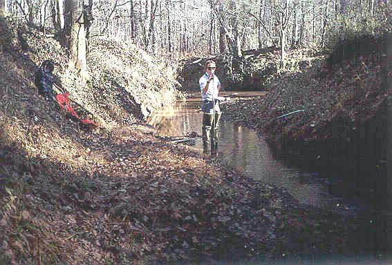
The Falling Creek HBN Basin is in the southern part of the Piedmont physiographic province in central Georgia (Figure 8.Map of the study area in the Falling Creek Basin and photograph of a typical tributary stream). The basin drains 187 km² of rolling terrain that ranges in elevation from 113 to 244 m. The USGS gaging station is 8 km east of the town of Juliette, Ga., at latitude 33°05'59'' and longitude 83°43'25''. Falling Creek is a south-flowing tributary of the Ocmulgee River with a channel length of about 18 km upstream from the gage and an average stream gradient of 3.8 m/km. The main channel is perennial, and average daily discharge ranges from 0.31 m³/s in September to 4.2 m³/s in February. Average annual runoff was 30 cm from 1965 through 1995 (U.S. Geological Survey, Water Resources Data, Georgia), of which almost 60 percent occurs during the 20 to 30 storm events each year (Rose, 1996). Climate of the area is temperate with warm, humid summers and mild winters (Payne, 1976). Precipitation averages 122 cm annually and is fairly evenly distributed throughout the year except for the fall months that are slightly drier (Plummer, 1983). Average daily air temperatures range from 7.3°C in January to 26.6°C in July. Freezing occurs on slightly more than one-half the days between December and February, although snowfall is rare (Payne, 1976).
Freeman Creek (12/90; A.Mast)
 |
The basin lies in the Southern Mixed Forest ecoregion (Bailey and others, 1994) and is covered by second-growth pine and mixed pine-hardwood forest types. Pine forests, which naturally reforested previously farmed or logged areas, are composed of loblolly pine with an understory of dogwood and redbud. Hardwood forest types are concentrated along the creek bottoms and in small, sheltered, upland valleys. The lowland hardwood species are predominantly sweetgum, water oak, and willow oak, and the upland hardwood stands are dominated by white oak, post oak, red oak, and hickory. Most soils in the basin are classified as Ultisols and are mapped in the Davidson series (Payne, 1976), which includes well- drained soils that have formed in residual material weathered from mafic crystalline rocks. A typical soil profile has a dark reddish-brown surface layer of loam (18 to 30 cm) that is underlain by dark-red clay subsoil that extends to a depth of almost 2 m. Soils are moderately to strongly acidic (pH 5.1 to 6.0) and have a low organic-matter content (Payne, 1976). Soil mineralogy is dominated by detrital plagioclase, potassium feldspar, pyroxene, biotite, hornblende, and quartz and pedogenic kaolinite with minor amounts of vermiculite (Rose, 1994). Soils are underlain by a layer of saprolite as much as 30 m thick that is the primary source of base flow to the stream (Rose, 1996).
Bedrock in the basin consists of interlayered felsic and mafic gneiss of Precambrian age. The felsic gneiss accounts for about one-third of the bedrock and consists of oligoclase, microcline, and quartz with accessory biotite, muscovite, garnet, sphene, magnetite, zircon, apatite, and epidote (Matthews, 1967). The primary minerals of the mafic gneiss include hornblende, andesine, and quartz with accessory epidote, magnetite, and apatite. The mafic gneiss weathers to an orange-red saprolite with a boxwork structure. Ultramafic rocks also are present in the basin including a large body of gabbro (12 km by 1.5 km) mapped along the northern basin divide roughly parallel to State Highway 83 (Vincent and others, 1990). The gabbro consists primarily of plagioclase, clinopyroxene, orthopyroxene, and olivine.
The Falling Creek Basin drains parts of Jasper and Jones Counties in central Georgia. Sixty percent of the basin is in the boundaries of the Oconee National Forest and 40 percent is in the boundaries of the Piedmont National Wildlife Refuge (PNWR). The PNWR is part of the National Wildlife Refuge System administered by the U.S. Fish and Wildlife Service, and the refuge headquarters is located just inside the southern basin boundary. About one-half the land in the National Forest boundary is owned by private individuals or logging companies. Most areas of the basin are accessible by the 50 km of Forest Service and county roads that traverse the area. The PNWR is open year-round for general public use, although some roads in the refuge may be closed during hunting season or in bad weather.
Public land in the basin was purchased by the Federal Government in the mid-1930's after almost 100 years of cotton farming had left severely eroded lands and nutrient-depleted soils. The PNWR was established in 1939 to develop techniques for reclaiming depleted areas and to restore suitable habitat for native animals (Riley and Riley, 1979). Current (1997) land cover in the basin is more than 95 percent forest and the dominant land use is for timber harvest, wildlife habitat, and recreation. Management policies of the PNWR are designed primarily to provide habitat for the endangered red-cockaded woodpecker. Pine forests in the refuge are managed on an 80-year rotation in stands of 4 to 12 ha, and hardwood stands are left to develop naturally (Ronnie Shell, Piedmont National Wildlife Refuge, oral commun., 1994). The refuge also manipulates water levels in natural wetlands, beaver ponds, and manmade ponds to improve food sources for birds. Pine forests in the Oconee National Forest are harvested on a 60-year rotation in a checkerboard pattern by clearcutting 12-ha parcels or thinning slightly larger areas (John Moore, Forest Service, oral commun., 1994). Some logged areas are left to revegetate naturally, whereas others are reseeded. Logging on private land has increased significantly during the past decade with clearcutting being the primary method of removal (John Moore, oral commun., 1994). Logging on private land has increased significantly during the past decade with clearcutting being the primary method of removal (John Moore, oral commun., 1994).
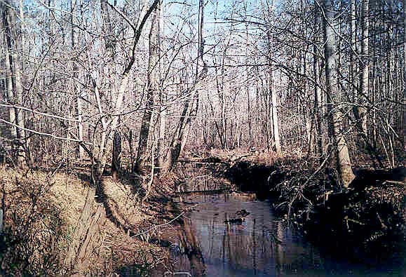
Hillsboro Creek (12/90; A. Mast)
 |
Other manmade features in the basin include several gravel pits and feldspar mines that were operated until the early 1980's and have since been revegetated or turned into ponds. A feldspar-processing plant, located just outside the northeast basin boundary, has discharged industrial wastewater into a settling pond at the head of Falling Creek for more than 30 years. The ore processing involves the use of hydrofluoric and sulfuric acids that generate acidic wastewater (Georgia Department of Natural Resources, 1985). The wastewater is treated with a caustic rinse to raise the pH then pumped into the settling pond. Discharge from the settling pond has been identified as a point source of both suspended sediment and chemical contamination to Falling Creek (Georgia Department of Natural Resources, 1985). A sample collected from the outlet of the settling pond in 1985 had a pH of 7.1 and fluoride and sulfate concentrations of 13.8 mg/L (730 meq/L) and 50 mg/L (1,040 meq/L), respectively (Georgia Department of Natural Resources, 1985). The impact of the industrial wastewater on the chemistry of Falling Creek is the reason this station was removed from the HBN in 1994.
Historical Water-Quality Data and Time-Series Trends
The chemical data set analyzed for this report includes 187 water-quality samples that were collected from October 1967 through June 1994 when the site was removed from the HBN. Water-quality samples were collected as frequently as monthly from 1968 through 1982 and quarterly from 1983 through 1994. Although not documented, water-quality samples in the early part of the record probably were analyzed at one of the three USGS laboratories (Raleigh, N.C.; Ocala, Fla.; Tuscaloosa, Ala.) that provided analytical services in the Southeastern Region (Durum, 1978). After establishment of the Central Laboratory System, samples were analyzed at the Central Laboratory in Atlanta, Ga., from 1973 through 1985 and at the NWQL in Arvada, Colo., from 1986 through 1994. Daily discharge records for Falling Creek (station 02212600) are available beginning in July 1964. Continuous records of water temperature at the gage were published from August 1965 through September 1979.
Calculated ion balances for 175 samples with complete major ion analyses are shown in figure 9. Ion balances ranged from -27 to +12 percent, and more than 85 percent of the samples had calculated values within the ±5 percent range, indicating that the analyses were of high quality. The mean charge balance of all samples was 0.2 percent, indicating that unmeasured constituents, such as organic anions, do not contribute significantly to the ion balance of stream water at this site.
Time-series plots of the major dissolved constituents were inspected for evidence of method-related effects (Figures 9a and 9b. Temporal variation of discharge, field pH, major ion concentrations, and ion balance at Falling Creek, Georgia). For example, several higher than average sulfate concentrations were reported during the late 1980's. This pattern coincides with the use of a turbidimetric titration for sulfate analyses at the NWQL between March 1986 and December 1989 (Fishman and others, 1994). In 1989, the NWQL determined that sulfate concentrations can be over-estimated by this technique and changed the method to ion chromatography in 1990 (Office of Water Quality Technical Memorandum No. 90.04, Turbidimetric Sulfate Method, issued December 21, 1989, at URL http://water.usgs.gov/admin/memo/). Sulfate and chloride both show a pattern of slightly smaller concentrations during the early 1970's. The fact that both silica and fluoride are missing for these same analyses may be an indication of a change in analytical laboratory during this period of record. The time-series plot of field pH shows an abrupt downward shift in pH around 1974 and many uncharacteristically low pH values during the next 6 years (fig. 9). Although not documented, these low values may have been caused by a change in the pH electrode used by field personnel. Some instrument-electrode systems are known to give erroneous readings when measuring pH in low-conductivity waters, and the electrode commonly is the critical component (Office of Water Quality Technical Memorandum No. 81.08, Electrodes for pH Measurement in Low-Conductivity Waters, issued February 10, 1981, at URL http://water.usgs.gov/admin/memo/).
Table 14 gives median concentrations and ranges of major constituents in stream water collected at the gage and VWM concentrations in wet-only deposition measured at the Georgia Station NADP station about 65 km west of the basin. Wet- precipitation chemistry at the NADP station is dilute and slightly acidic with a VWM pH of 4.6. During 17 years of record, the dominant cations in precipitation were hydrogen, which contributed 50 percent of the total cation charge, and ammonium and sodium, which contributed 19 and 15 percent, respectively. Sulfate was the dominant anion, accounting for 62 percent of the total anions, whereas nitrate and chloride accounted for 23 and 15 percent, respectively. These data indicate that solutes in precipitation in the basin are primarily a mixture of strong acids derived from anthropogenic emissions of sulfur and nitrogen compounds, which cause acid rain.
Source: pubs. usgs.gov