

Looking down Bay Street
Beaufort is a city and county seat in Beaufort County, South Carolina, United States. Chartered in 1711, it is the second-oldest city in South Carolina, behind Charleston. The city's population was 12,950 in the 2000 census (46,227 total pop. of Beaufort Urban Cluster). It is located in the Hilton Head Island-Beaufort Micropolitan Area.

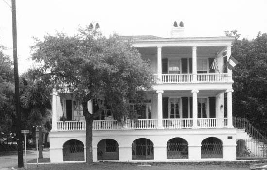
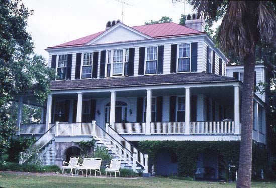
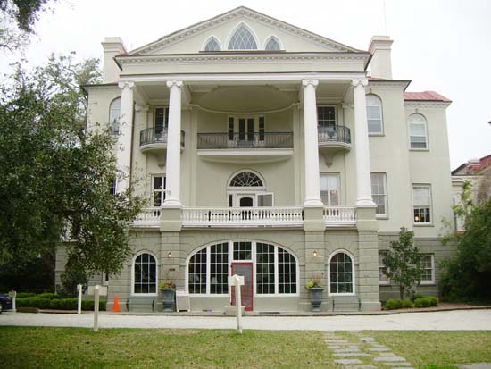
Tidalholm, 1 Laurens Street, Beaufort, Beaufort County, SC
Beaufort (pronounced /ˈbjuːfərt/ BEW-fərt, unlike its counterpart in North Carolina) is located on Port Royal Island, in the heart of the Sea Islands and Lowcountry. The city is renowned for its scenic location and for maintaining a historic character through its impressive antebellum architecture. The city is also known for its military establishments, being located in close proximity to Parris Island and a U.S. Naval Hospital, in addition to being home of the Marine Corps Air Station Beaufort.

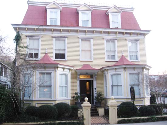
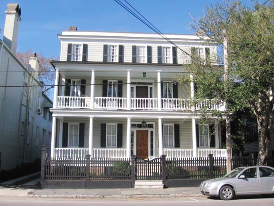
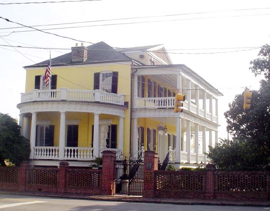
Tidewater, 302 Federal Street, Beaufort, Beaufort County, SC
The city has been featured in the New York Times, named "Best Small Southern Town" by Southern Living, named a "Top 25 Small City Arts Destination" by American Style, named a "Top 20 Fishing Town" by Field and Stream, and a "Top 50 Adventure Town" by National Geographic Adventure.

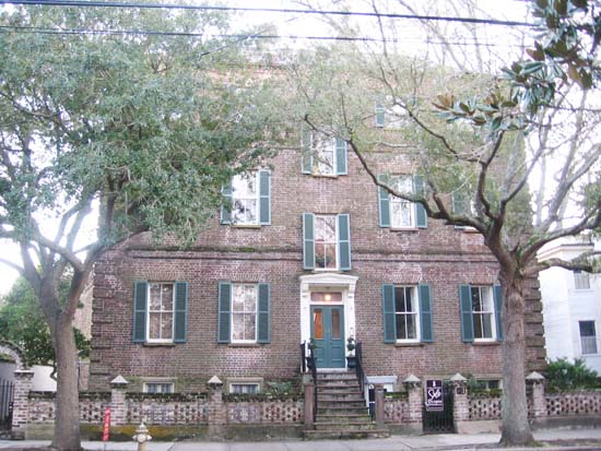
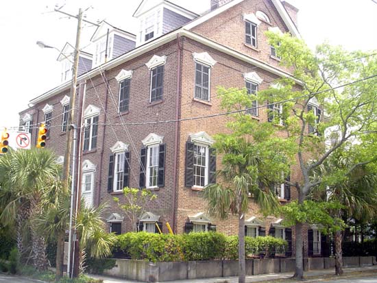
Cassena (House), 315 Federal Street, Beaufort
History
The Lowcountry region had been subject to numerous European explorations and several aborted attempts at colonization before the British successfully founded the city in 1711. The city initially grew slowly, subject to numerous attacks from Native American tribes and threats of Spanish invasion before flourishing as a center for shipbuilding and later in the antebellum period as the aristocratic center for the Lowcountry plantation economy up through the Civil War.

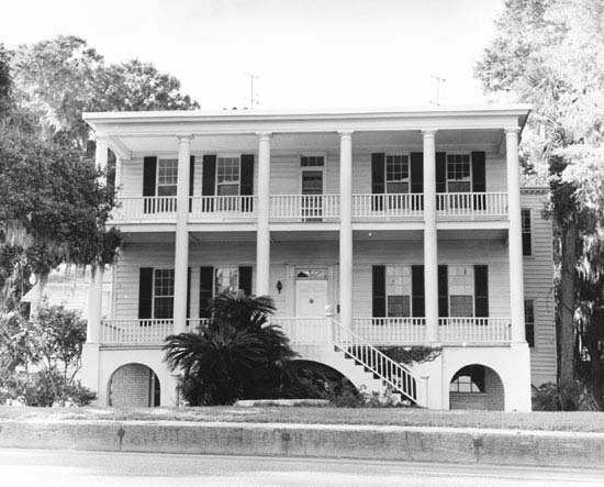
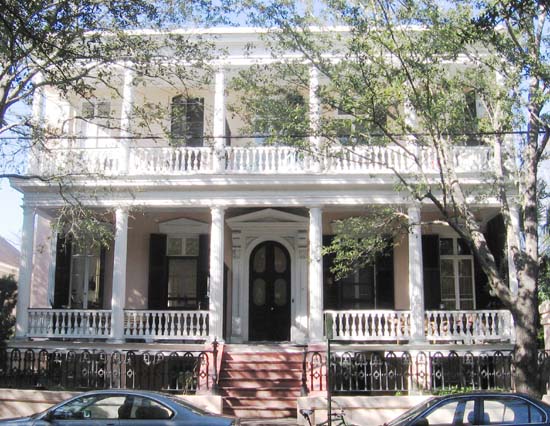
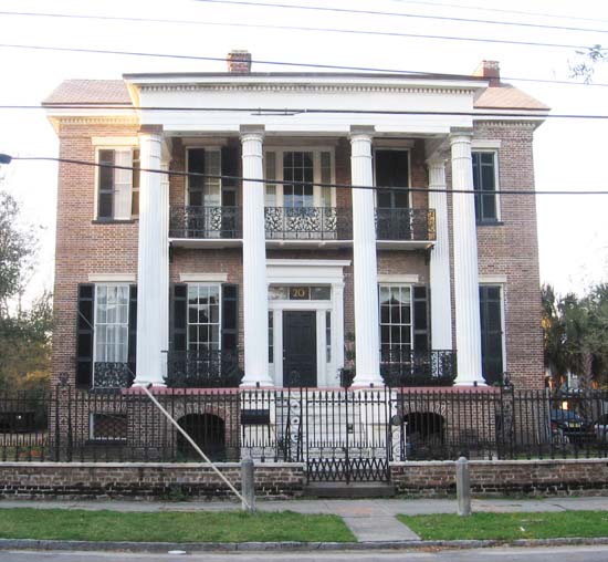
The Oaks, 100 Laurens Street, Beaufort
Several months after hostilities began between the states, Beaufort was occupied by Union forces following the Battle of Port Royal. Due in part to its early occupation, the city became a center of emancipation efforts for newly freed slaves during the war and into Reconstruction. After the war, the city relied on phosphate mining before a devastating hurricane in 1893 and a fire in 1907 brought economic turmoil and stagnant growth to the city for nearly half a century. The community rebounded in the later half of the 20th century due to the growth of the military presence and the development of tourism. In spite of new development, Beaufort has retained much of its historic character through its renowned architecture and historic preservation efforts.

Beaufort Volunteer Artillery, 713 Craven Street, Beaufort,
Neighborhoods
Historic District
The original settlement of Beaufort can be found in the downtown or historic district area. 304 acres (1.23 km2) of the town have been designated a National Historic Landmark. With approximate dimensions, downtown is defined as anything upon the peninsula jutting into the Beaufort River that is located east of Ribaut Road (US 21). Further defined, downtown is broken into five distinct neighborhoods:

Downtown Beaufort as seen from the Woods Memorial Bridge.
Downtown is centered along Bay Street, Beaufort's historic commercial street. It includes other nearby streets and is mainly commercial in character. Located between the Beaufort River and Bay Street is the newly renovated Henry Chambers Waterfront Park, which overlooks the Beaufort River and is home to many of the city's festivals and events. Most non-tourist commercial services have since relocated to areas such as Boundary Street, Ribaut Road, and Lady's Island.
Secession House, 1113 Craven Street, Beaufort
The Point neighborhood (also known as the Old Point) is home to some of Beaufort's largest, oldest, and most expensive homes. Defined as the land between Carteret Street and the Beaufort River, this portion of downtown does not follow the major street grid.
Thomas Barksdale House, 27 George St., Constructed: ca. 1817
The Bluff area is located along Bay Street and North Street, immediately west of downtown. The large homes in the area are some of the most recognizable in the city and have a scenic overlook of the Beaufort River. The art-deco style U.S. District Courthouse is located at the western end of the Bluff.
Robert Means House, 1207 Bay Street, Beaufort, Constructed: ca. 1800
The Old Commons neighborhood (also known as the Northeast Quadrant) is located in the northeastern portion of Beaufort's original street grid, defined as the area between Carteret Street on the east, North Street on the south, Charles Street on the west, and Boundary Street to the north. Originally home to a hodgepodge of medium-sized homes, graveyards, and chapels, this section of downtown is undergoing reinvestment and redevelopment, yet retains a southern style of architecture.
The Northwest Quadrant neighborhood, loosely defined as the area between Charles Street on the east, Prince Street to the south, Ribaut Road on the west, and Boundary Street to the north. This area has for generations been the center of Beaufort's African-American community and is composed of late 19th and early 20th century homes, many in a shotgun architectural style. Bladen Street serves as the principal street through the community and was recently renovated with improved landscaping and pedestrian access.

Frederick Fraser House, 901 Prince Street
Other Areas
Uptown refers to a series of mostly commercial properties along Boundary Street, which separates the historic district from the Pigeon Point neighborhood. Uptown is not formally considered a neighborhood on its own, yet merchants have created a unique identity to market the commercial area separately from downtown merchants clustered on Bay Street.
Gov. William Aiken House, 48 Elizabeth St.,
The Pigeon Point neighborhood is located immediately north of Downtown Beaufort and is bound on the west by the Beaufort National Cemetery. It is centered around two major city parks: Pigeon Point Community Park and the Basil Green Recreation Complex. An area with smaller homes and mostly one-story early 20th century structures, Pigeon Point has experienced a renewal of development interest, with many homes being "flipped" or renovated in recent years.

Thomas Rhett House, 1009 Craven Street,
The Depot neighborhood is located west of Ribaut Road, south of Boundary Street and north of the Technical College of the Lowcountry campus. It has been the focus of recent redevelopment efforts with regards to home improvements. Formerly concentrated around the Beaufort rail station (the depot), the neighborhood has similar characteristics to the Pigeon Point community and has many military families living in it, due in part to the proximity of Beaufort's military institutions.
The Spanish Point neighborhood is located between Downtown and Mossy Oaks, generally considered to be clustered around the Technical College of the Lowcountry campus and the Beaufort Memorial Hospital. Several upscale residential neighborhoods and healthcare-oriented commercial establishments are typical characteristics of this area.

James Rhett House, 303 Federal Street,
The Mossy Oaks neighborhood is at the southern edge of the city limits (along the border of Port Royal), generally considered to be south of the Technical College of the Lowcountry campus and the Beaufort Memorial Hospital. There are some commercial establishments in the area in addition to residential neighborhoods ranging from apartments to smaller single-family homes and duplexes.

John Cuthbert House, 1203 Bay Street,
Portions of Lady's Island have been annexed by Beaufort, though the City does not have complete jurisdiction of the entire island. Most of the incorporated areas are upscale residential communities and the Beaufort County Airport.

McKee-Smalls House, 511 Prince Street,
Beaufort Town Center is a recent term given to a series of developments along Boundary Street located west of the historic district and Pigeon Point that is clustered near the Beaufort County government complex and the City of Beaufort's municipal complex construction site. Though much of the area (and the term) is owned by a single developer, many of Beaufort's commercial properties and administrative uses have moved to this area.

James Jervey House, Dependencies, 55 Laurens Street,
Once the outer edge of town, the corridors along Boundary Street (US Highway 21), Robert Smalls Parkway (SC Highway 170), and Ribaut Road now serve as Beaufort's major commercial corridors. Several major shopping centers in addition to numerous dining establishments and lodging facilities are the standard business types in this area.

Thomas E. Ledbetter House, 411 Bayard Street,
The Marine Corps Air Station Beaufort was annexed into the City in the 1990's, expanding the city limits northward near the unincorporated Seabrook community. Previous attempts at bringing large-scale residential development north of the air station were defeated after protests from long-time citizens and environmental advocacy groups.

John Joyner Smith House, 400 Wilmington Street,
Culture
Media
Beaufort's major daily newspaper is The Beaufort Gazette. The Beaufort area also has a weekly newspaper known as The Island News and some online newspapers like The Beaufort Bulletin and The Beaufort Tribune.

W. J. Jenkins House, 901 Craven Street,
Several radio stations have transmission feeds originating or duplicating in Beaufort.
Beaufort has one local television station, WJWJ-TV (PBS). Beaufort is part of the Savannah, Georgia Designated Market Area, and additionally receives Charleston television stations.

Louis Cuthbert House, 915 Port Republic Street,
Books and film
Beaufort has been the setting for several novels by native son Pat Conroy, and a popular filming location for major motion pictures, including The Big Chill, The Prince of Tides, The Great Santini, Forrest Gump, Something To Talk About and G.I. Jane. Lady's Island and the slave trade is the subject of an award winning novel by Lawrence Hill, The Book of Negroes (a/k/a Someone Knows My Name).
James Robert Verdier House, 501 Pinckney Street,
(James Robert Verdier House) Marshlands was built ca. 1814 for Dr. James Robert Verdier, who achieved prominence when he discovered a treatment for yellow fever. During the Civil War, this house was used as headquarters for the United States Sanitary Commission. Set high from the ground upon a tabby arcade, the two-story house gives evidence of Barbadian influence in the single story veranda that runs the length of the front and to the sides. This West Indian influence is well-blended with the more formal Adamesque features of the Republican period. The sheet metal roof is painted red and the shutters are dark green. The tabby arches of the cellar are pale pink. Double stairs lead to the porch landing; the front entrance has both a fanlight and sidelights. The interior mantels, particularly those in the dining room and the drawing room, are fine Adam designs. Listed in the National Register November 7, 1973; Designated a National Historic Landmark November 7, 1973.
Tourism and events
Beaufort is a romantic and popular tourist destination known for its history. Major festivals and arts events include the Water Festival, a two-week extravaganza in the middle of July, the Shrimp Festival, celebrating the local and traditional industry, is in the second weekend in October. In 2007, The Beaufort Shrimp Festival was selected as one of the Southeast Tourism Society's Top 20 Events. The Beaufort International Film Festival held the first week of March screens independent films, such as Brats. A Taste of Beaufort, presented by Main Street Beaufort, is held on the first Saturday in May and features 20 local restaurants, fine wines and live music. Chalk on the Walk at Beaufort Town Center is an interactive festival focusing on bringing street art to and by the people, and is produced the Arts Council of Beaufort County. For more information on all events and visiting the area, please contact the Beaufort Regional Chamber of Commerce and Visitor Center.

Thomas Hepworth House, 214 New Street,
The arts
Beaufort has been named by some sources as one of "America's Best Art Towns", including being ranked the #14 Small City Arts Destination by American Style Magazine in 2008 and one of America's top 100 art towns by author John Villani in his 2005 book "The 100 Best Art Towns in America: A Guide to Galleries, Museums, Festivals, Lodging and Dining" . Close to 20 galleries operate within the City with hundreds of local residents contibuting to the arts scene.


Colonel Edward Means House, 604 Pinckney Street,
The University of South Carolina-Beaufort has a performing arts center which attracts regional and national acts to the community.
The Arts Council of Beaufort County, nurtures the arts via ARTworks, its 12,000 square foot community arts center, theater, and gallery in Beaufort Town Center (2127Boundary Street, 29902) that also includes the studios of working artists, Coastal Art Supply, and spaces for worshops, classes, and conferences, as well as an afterschool program. The arts council promotes the arts with original theater productions, community arts grants, the Get Your Art Out emerging artist initiative, ArtNews, a print magazine, and the Detour for the Arts online calendar for arts events county-wide.

Maxcy-Rhett House, 1111 Craven & Church Streets,
Sports and recreation
Through Beaufort County's Recreation Department, junior and intramural athletics are sponsored year-round. Activities include football, basketball, baseball, softball, soccer, and cheerleading.

Dr. Joseph Johnson House, 411 Craven Street,
The local area provides excellent opportunities for golf, fishing, and kayaking.
Hopton-Muckenfuss House, 122 Wentworth St., Constructed: ca. 1830
Henry Cobia House, 128 Wentworth St., Constructed: ca. 1840
James Nicholson House, 172 Rutledge Ave., Constructed: ca. 1816

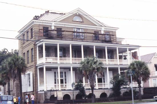
John Mark Verdier House, 801 Bay & Scott Streets,
In February 2008, Field and Stream Magazine rated Beaufort as one of the top 20 fishing towns in the United States in an article which factored in cost, attractions, distractions, seasons, and fishing action. Beaufort was also named as a "Top 50 Adventure Town" and the #7 Waterfront Adventure Town by National Geographic Adventure .


St. Helena's Episcopal Church, 501 Church Street,
Religion
The city is home to many Christian denominations, with several churches located in the downtown area and throughout the area. St. Helena's Episcopal Church in downtown Beaufort was founded in 1712. A Jewish house of worship, Beth Israel Synagogue, is also in the downtown area, adjacent to the Beaufort Arsenal and Museum.

First African Baptist Church (circa 1865), 601 New Street,

Prince William's Parish Church (Ruins),
Economy
The location of the City to other fast growing areas including Hilton Head Island, and Bluffton as well as good access to Savannah, Georgia, the Savannah-Hilton Head International Airport, and a future container port to be built on the Savannah River make the city a desirable choice for residential and business development opportunity.

Thomas Fuller House, 1211 Bay Street,
Higher education
Three local institutions comprise the current extent of higher education in the Beaufort area. Both the University of South Carolina Beaufort Main Campus and the Technical College of the Lowcountry Beaufort Campus are located within the city limits. Clemson University also operates a university extension office in the city with ecological and agricultural programs.

Elizabeth Barnwell Gough House, 705 Washington Street,
Libraries and museums
Beaufort has close to 70 sites listed on the National Register of Historic Places, in addition to the entire historic downtown being listed as a historic district.

Elliot House, 1103 Bay Street,
The Beaufort Arsenal and Museum serves as both the city's major museum and a point of interest in Beaufort's history. The Verdier House at 901 Bay Street is one of the oldest homes in the city and the only home open to the public that is listed on the National Register of Historic Places.

Saltus-Habersham House, 802 Bay Street,
Located in downtown, the Beaufort County Library serves residents of Beaufort and northern Beaufort County. Additional branches are found elsewhere in the county. The University of South Carolina Beaufort also has a campus library, located in the original Beaufort College building.

Berners Barnwell Sams House, 201 Laurens Street,
Infrastructure
Major roads
The following thoroughfares are important transportation links in Beaufort.

Haig Point Tabby Ruins, Haig Point Road, Daufuskie Landing,
U.S. Highway 21, is the major connector through the city and the principal route to the Sea Islands. It is also known as Trask Parkway west of the SC 170 intersection, Boundary Street, and Ribaut Road. Originally going through downtown and across the Robert Woods Memorial Bridge, US 21 was rerouted to the south upon the completion of the taller and wider J.E. McTeer Bridge in the 1980s. Once rejoined with "Business 21" on Lady's Island the route is known as Sea Island Parkway and travels through Lady's Island, St. Helena Island, and Harbor Island before ending to become a county route on Hunting Island, which continues to the private Fripp Island community.


Retreat Plantation, 130 Pinckney Retreat Road, Beaufort vicinity,
Business U.S. Highway 21, also known locally as "Business 21" or more specifically as Boundary Street and Carteret Street is the major arterial through downtown Beaufort. Starting at the US 21 split, the route travels eastward along Boundary Street to the Bellamy Curve at the edge of the peninsula, then turns sharply towards the south along Carteret Street until reaching the Woods Memorial Bridge (drawbridge) over the Beaufort River. The route continues onto Ladys Island before rejoining US 21.
S.C. Highway 116, also known as Laurel Bay Road connects the Marine Corps Air Station with the military housing community at Laurel Bay, as well as other communities such as Laurel Bay and Habersham
S.C. Highway 170, also known as the Robert T. Smalls Parkway serves as the primary connection between Beaufort and southern Beaufort County, Jasper County, and Savannah.
S.C. Highway 280, also known as the Parris Island Gateway runs along the western fringes of the City Limits, connecting U.S. 21 with S.C. Highway 802, creating a western bypass of downtown Beaufort.
S.C. Highway 802, also known as Lady's Island Drive connects Lady's Island and the eastern Sea Islands with Port Royal, Parris Island, Shell Point, and points west. It provides an alternative reliever route so motorists can avoid downtown Beaufort. The route is co-signed with US Highway 21 over the McTeer Bridge.
Although not located within Beaufort's city limits, these routes provide vital access to the city and are major evacuation routes in the event of a hurricane.
U.S. Highway 17, runs along the northern portion of Beaufort County as Trask Parkway between Interstate 95 exit 33 and U.S. Highway 21. This is also the primary route used between Beaufort and Charleston, as well as Walterboro and Yemassee
Interstate 95 is the closest interstate highway to Beaufort and is located about 25 miles away. Beaufort can be easily accessed via exits 8, 33, 38, and 42, depending on the direction of approach.
Local public transportation and dial-a-ride service is provided by Palmetto Breeze, a regional transportation authority run by the Lowcountry Council of Governments, which serves as the regional Metropolitan Planning Organization (MPO).
Primerose House, 332 E. Bay St., Constructed: ca. 1817
Other transportation
Beaufort is one of the most popular harbors on the Intracoastal WaterwayOther transportation facilities include the following:
The Downtown Marina is Beaufort's nautical gateway to the Intracoastal Waterway and the surrounding Sea Islands. Additional marinas are located on Lady's Island and in Port Royal. Several boat landings exist in the city and in the surrounding areas.
The Beaufort County Airport, located three miles east of downtown on Lady's Island provides general aviation services. The closest airports served by commercial carriers are found on Hilton Head Island, Charleston and Savannah.
The Port Royal Railroad served Beaufort and surrounding locales with freight rail service until the closing of the South Carolina Port Authority terminal just south of the City in 2004. The rail at one time also had passenger service and was used by Marine Corps recruits to reach Parris Island. Currently closed between Yemassee and Port Royal, there are continuing discussions about the future of the rail line.'
Jospeh Aiken House, 20 Charlotte St., Constructed: 1848
Utilities
Water and sewer services are provided by the Beaufort-Jasper Water & Sewer Authority (BJWSA), a regional utility agency.

Beaufort, South Carolina. View of Beaufort from the waterfront. Fuller's House
City trash and recycling pickup are coordinated by the city and billed through BJWSA.
John Hume Simons House, 76 Ashley Ave., Constructed: ca. 1855
Dress parade of the 1st South Carolina [U.S.C.V.], Beaufort, S.C.
Hargray and Embarq provide telephone, digital, and cable television services to the city.

Beaufort, South Carolina. Robert Barnwell Rhett's residence
Headquarters of Gen. Thomas West Sherman, Beaufort, S.C., and soldiers with musical instruments standing on and in front of porch
Beaufort, South Carolina. Boat landing
Notable residents and natives Actors, authors, and entertainers
Danni Ashe, adult entertainer
Tom Berenger, actor
Pat Conroy, author of numerous novels with several depicting communities resembling Beaufort'
Esther Dale, former actress
Jazzy Jay, hip-hop disc jockey
Jessica Verday, author
Athletes
Kevin Brooks, basketball, National Basketball Association and National Basketball League (Australia)
Joe Frazier, boxer
Joe Montford, football, Canadian Football League
James Saxon, football player and coach, National Football League
Greg Jones, (American football) Jacksonville Jaguars fullback
Politicians and leaders
Robert Barnwell, former U.S. Congressman
Robert Woodward Barnwell, former U.S. and Confederate Congressman
Edward Junius Black, former U.S. Congressman (represented Georgia)
William F. Colcock, former U.S. Congressman
Charles Craven, former governor and founder of Beaufort
William Elliot, former U.S. Congressman
John Floyd, former U.S. Congressman (represented Georgia)
Richard Howell Gleaves, former Lieutenant Governor of South Carolina
William J. Grayson, former U.S. Congressman and poet
Francis Lubbock, former governor of Texas
Michael P. O'Connor, former U.S. Congressman
Libby Pataki, wife of former Governor of New York George Pataki
Clementa C. Pinckney, current state senator
Robert Rhett, former U.S. Congressman and leading secessionist politician
Robert Smalls, former slave who became one of the first African-Americans elected to the U.S. Congress
William Verity, Jr., former U.S. Secretary of Commerce
Others
Richard W. Colcock, former president of The Citadel
Donald Conroy, former colonel, USMC; also known as "The Great Santini" and father of Pat Conroy
Stephen Elliot, former Episcopal bishop
John Edwards Holbrook, former zoologist
Anita Pollitzer, former photographer
Anne Pressly, former news anchor whose murder in Arkansas attracted national attention
Beaufort, South Carolina. "Our mess"
Beaufort, South Carolina. Fuller's house
Beaufort, S.C. Gen. Isaac I. Stevens on same porch
Beaufort, S.C. Gen. Isaac I. Stevens (seated) and staff on porch of a house
Beaufort, South Carolina. Erecting pontoon bridge across Port Royal River
Beaufort, South Carolina. Shooting party on J.J. Smith's plantation
Beaufort, South Carolina. Federal signal station. Formerly the home of John G. Barnwell
Beaufort, S.C. 50th Pennsylvania Infantry in parade formation
Beaufort, South Carolina. Negro family representing several generations. All born on the plantation of J.J. Smith
External links:
Beaufort Historic District
History of Beaufort, South Carolina
Battle of Beaufort
Battle of Port Royal
Treaty of Beaufort
City of Beaufort
Beaufort, SC Convention and Visitor's Bureau
Beaufort Gazette
Arts Council of Beaufort County
Beaufort Regional Chamber of Commerce & Visitor's Center

